Let's Go There.
Plan, map and log your hunts with simple tools for sharing and keeping track of what matters. Built for guides and DIY hunters.
Built for the field
Every feature designed with real hunting scenarios in mind. Simple, reliable, and focused on what you need.
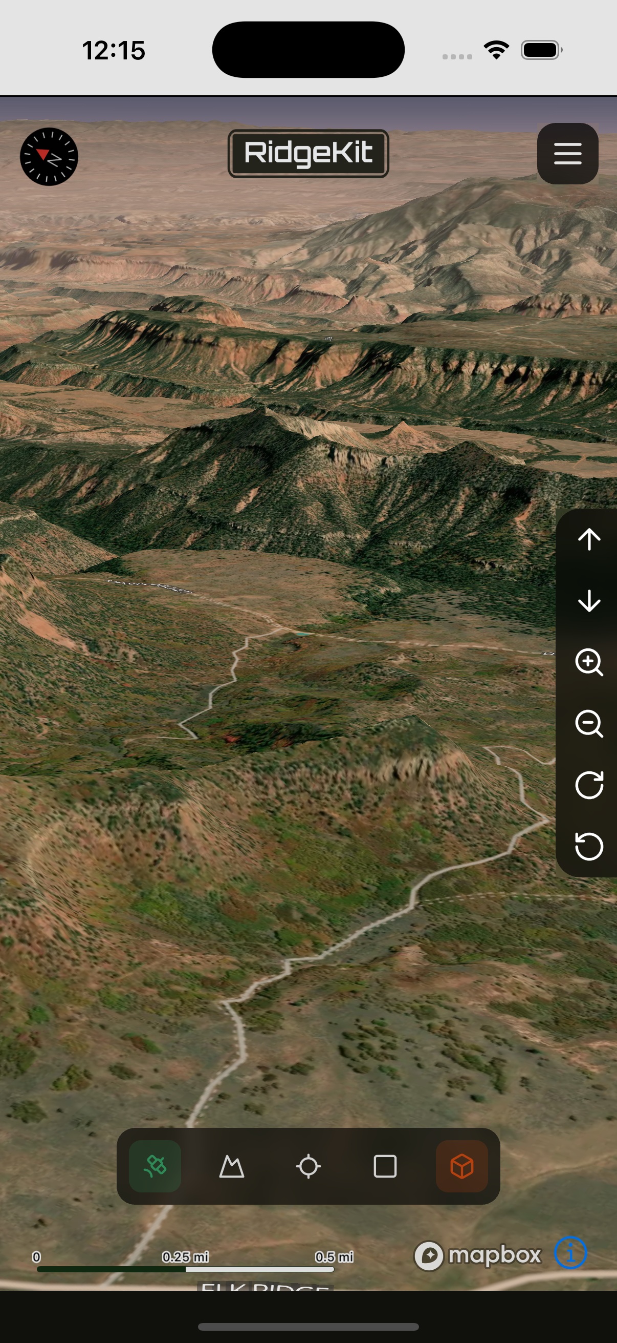
Interactive Maps
Navigate with confidence
View detailed topographic maps with satellite imagery. Mark waypoints, track your routes, and plan your hunts with precision. Works seamlessly with offline mode for remote areas.
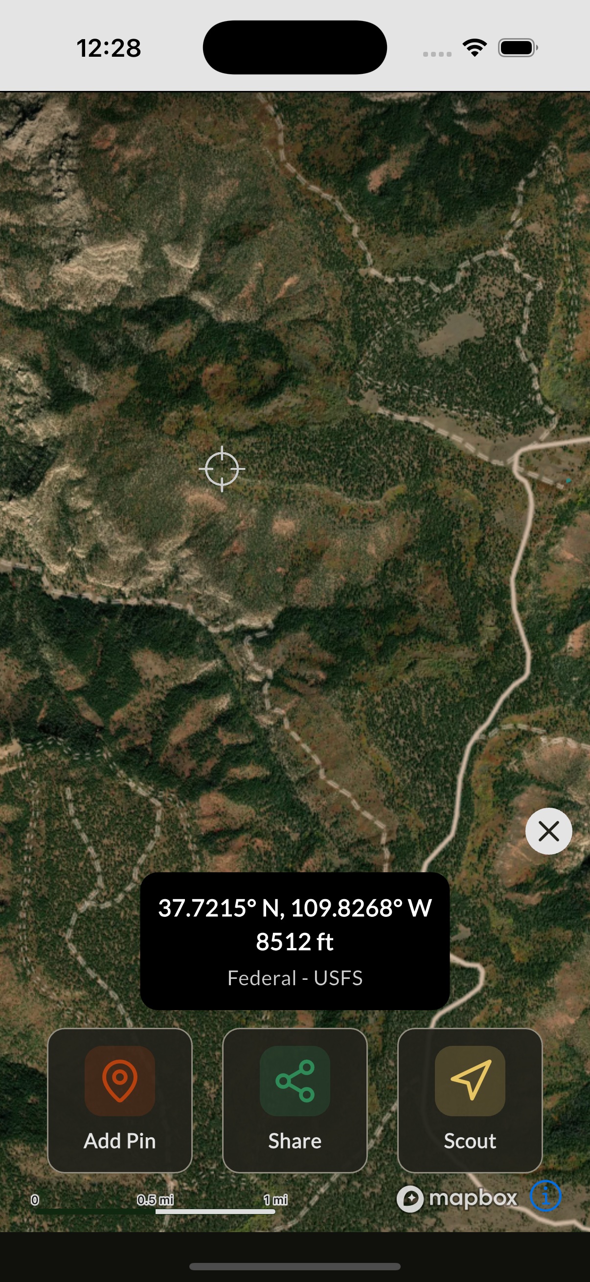
Smart Pins
Mark what matters
Drop pins for stands, trails, sightings, and more. Add photos, notes, and timestamps to each location. Organize pins by hunt, season, or custom categories.
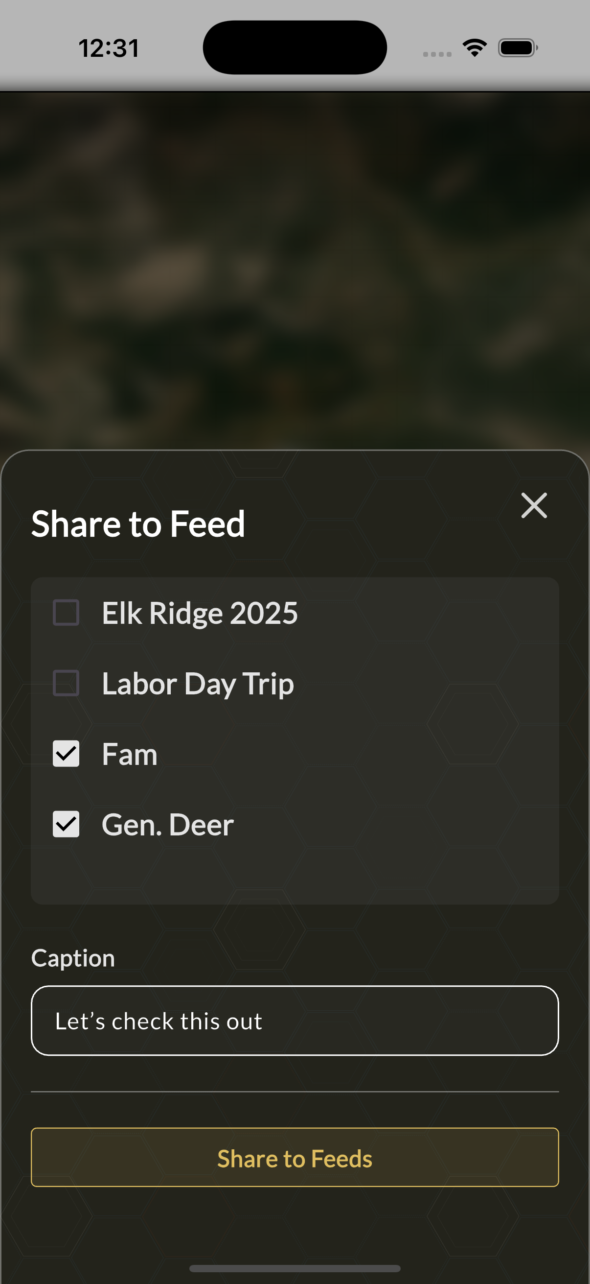
Shared Feeds
Collaborate with your crew
Create private feeds to share locations, photos, and updates with your hunting party. Real-time sync keeps everyone informed, even when you're miles apart.
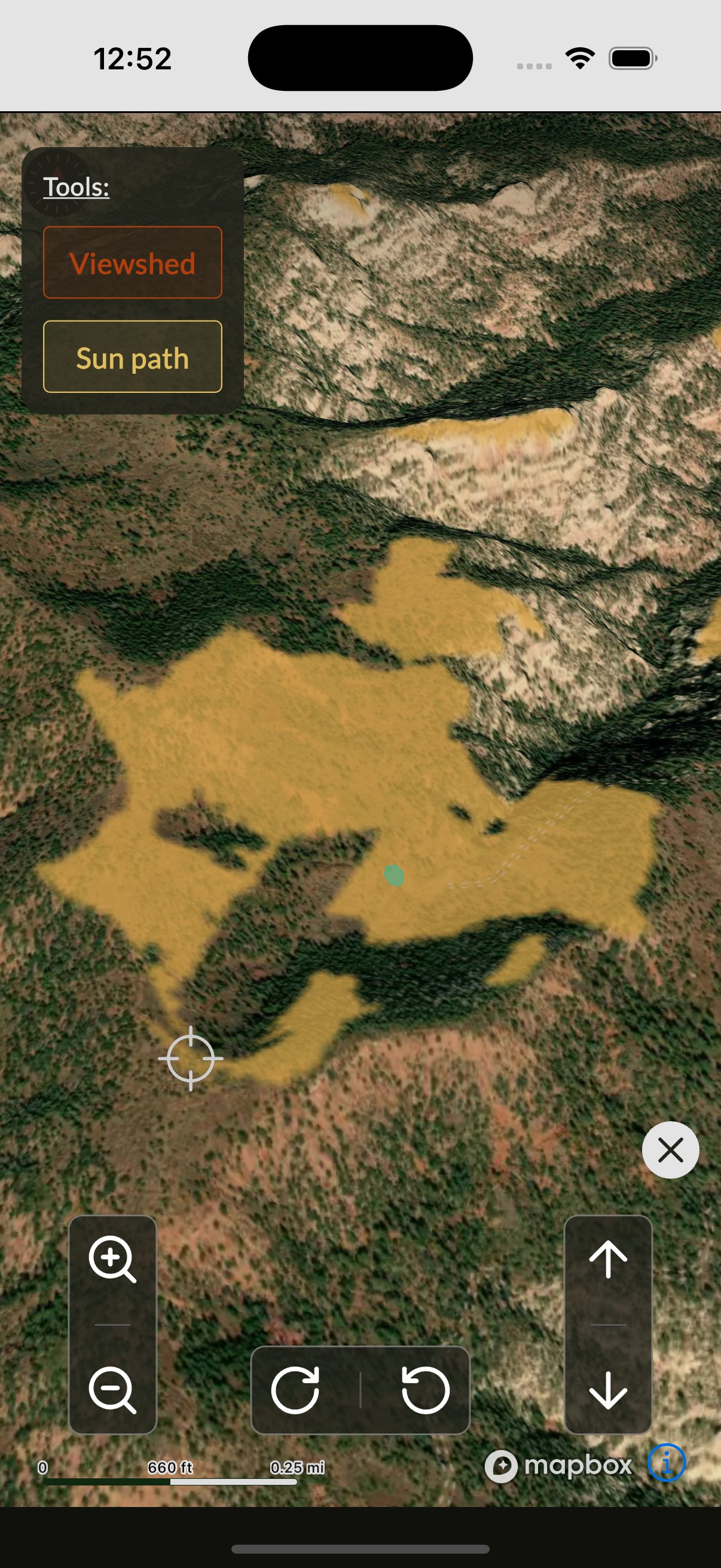
Scout Tools
Plan like a pro
Access useful e-scout tools such as viewshed analysis and sun path. Make informed decisions with data that matters in the field.
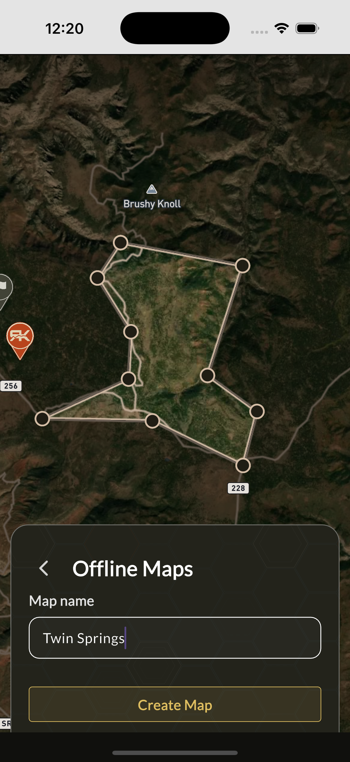
Offline Mode
No signal? No problem
Download maps and data before you head out. All core features work without cell service. Your pins, notes, and logs sync automatically when you're back online.
All Features
| Feature | Status |
|---|---|
| Satellite, Topo base maps | Built |
| 3D mode | Built |
| USFS, BLM roads and trails | Built |
| Intuitive map controls | Built |
| Offline maps | Built |
| Pins | Built |
| Feeds | Built |
| Viewshed analysis | Built |
| Sun path | Built |
| Public land classification | Built |
| Distance & elevation tools | Built |
| Tracking | Coming Soon |
| Live Feed | Coming Soon |
| 2024 Satellite Imagery (Utah) | Coming Soon |